

517
Deutschland
Schmettau, Topographisch Oeconomisch u. Militairische Charte ... Mecklenburg-Schwerin. 1788
Estimate:
€ 2,000 / $ 2,140 Sold:
€ 1,200 / $ 1,284 (incl. surcharge)
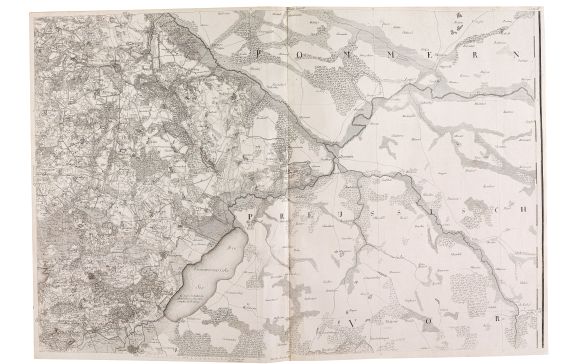
LGK II, 710. - Monumental and exemplary special map of Mecklenburg-Schwerin in 16 single maps or "Sections", bound as an atlas. Released as a part of the so-called Schulenburg-Schmettau cartography on all Prussian provinces. The map still served as a model for many later maps of Mecklenburg. - Engr. by I. Alberti, C. Jaeck (sect. X and XIII) and C. F. Gürsch sect. VI, 1792). - Title of section 1 in form of a large scroll as well as an overview of the complete map, sect. IV contains a side map of the Ribnitz district, the legend and a compass rose, a sidemap of the Prignitz and the county Ruppin on sect. XVI. -

517
Deutschland
Schmettau, Topographisch Oeconomisch u. Militairische Charte ... Mecklenburg-Schwerin. 1788
Estimate:
€ 2,000 / $ 2,140 Sold:
€ 1,200 / $ 1,284 (incl. surcharge)